
Ontario's Municipal Property Assessment Corporation is the agency responsible for evaluating buildings in Ontario for tax purposes. All 278 cottages in Rondeau have been assessed and issued their own Roll Numbers under the Municipality of Chatham-Kent. MPAC uses very accurate digital mapping data to plot where each lot begins and ends. While MPAC's maps are hard to read, they are the definitive reference showing property lines. In Rondeau, privately-owned structures (including the cottage, garage, and any sheds) must all be contained within the property lines. Zoomed-out, MPAC's maps give a high-level overview of how small our cottage lots are relative to the public parkland surrounding them.
The Facts About Cottage Property Lines...
This first pair of photos shows an aerial image taken from MPAC's public website of eight cottages in the general area of the Visitor Centre. The left photo is unmodified; the right photo has text added for clarification. Each of these cottage lots are 50' wide X 125' deep. The cottage lot parcels are indicated in red; the cottage itself is just a portion of each rectangle. In most cases the propery line ends about 10' from the cottage back door, then it's public all the way down to the lake.
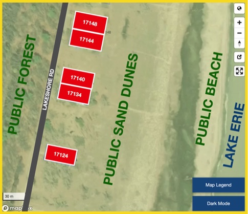
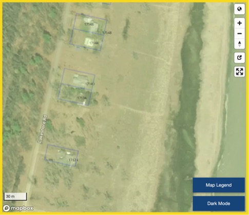
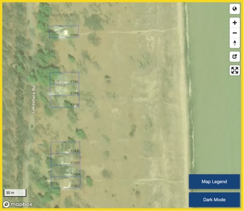
This second pair of photos shows an aerial image taken from MPAC's public website of five cottages in the general area of the Dog Beach. The left photo is unmodified; the right photo has text added for clarification. The cottage lot parcels are indicated in red. If it's NOT red, then it's always been public and always will be public. Any claim that private land dominates the shoreline is unfounded.